Dunino
| Also known as: | Dunino Aerodrome / HMS Jackdaw II / RAF Dunino / RAF Station, Dunino / RNAS Dunino |
| County: | Fife |
| Current Status: | Farmland |
| Date: | April 1941 - 1957 |
| Current Use: | Disused |
| Used By: | RAF / FAA |
| Landing Surface Types: | Unpaved, later metal/unpaved |
| Aircraft Roles: | Army aviation / Fighter-reconnaissance / Naval aviation |
Land at Dunino in Fife was acquisitioned for use as a satellite airfield for Leuchars in 1939. However, it was not until May 1941 that the only major RAF users of the site moved here, Westland Lysanders of No 309 (Polish) Squadron. This unit flew from various airfields around Scotland, as well as Gatwick further south, carrying out training in army co-operation. The Lysanders were replaced with North American Mustangs by the summer of 1942 before moving to Findo Gask in November 1942.
Dunino was transferred next month to the Royal Navy to become HMS Jackdaw II, primarily for Torpedo Bomber Reconnaissance use. Fairey Barracudas and Swordfish carried out this role from the airfield. Air-Sea Rescue Supermarine Walrus aircraft were also based here, as well as Dunino seeing use by Fleet Requirements Unit No 770 Squadron, though from mid-1944 aircraft storage became the primary use of this airfield. Although closure occurred in 1946 the site was retained by the Navy until 1957.
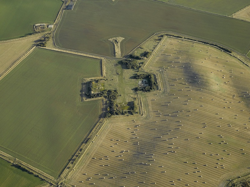
Dunino was equipped with a single surfaced metal runway and three grass strips. Most of the site has now been demolished leaving just part of the perimeter track, the control tower, at least two hangars and a few other miscellaneous buildings.
The following organisations are either based at, use and/or have at least potentially significant connections with the airfield (as at 01/07/2013):
- Boarshills and Dunino Community Council
- Kingsbarns Community Council
Main unit(s) present:
-
No 309 Sqn
-
No 737 Sqn
-
No 770 Sqn
-
No 785 Sqn
-
No 786 Sqn
-
No 813 Sqn
-
No 820 Sqn
-
No 824 Sqn
-
No 825 Sqn
-
No 827 Sqn
-
No 833 Sqn
-
No 837 Sqn
-
No 837A Flight
-
No 837D Flight
-
No 838 Sqn
-
No 860 Sqn
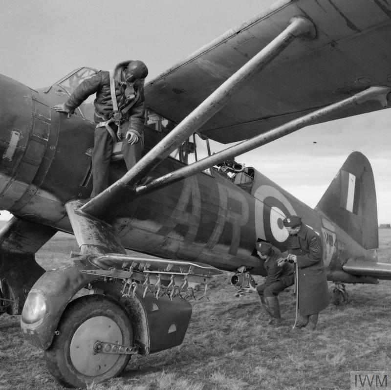
A Westland Lysander of No 309 Polish Fighter-Reconnaissance Squadron at Dunino, 12 March 1942. © IWM (H 17778)
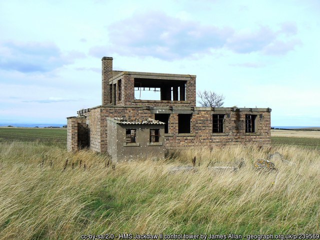
The control tower at Dunino, 6 September 2006.
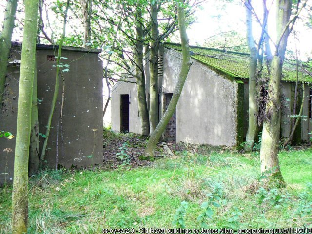
Second World War buildings at Dunino, 29 October 2007.
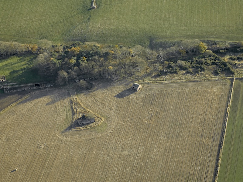
Aerial view centred on the north-east dispersal area with the farmstead adjacent, taken from the west, 23 November 2007. © Crown Copyright: HES. Licensor canmore.org.uk
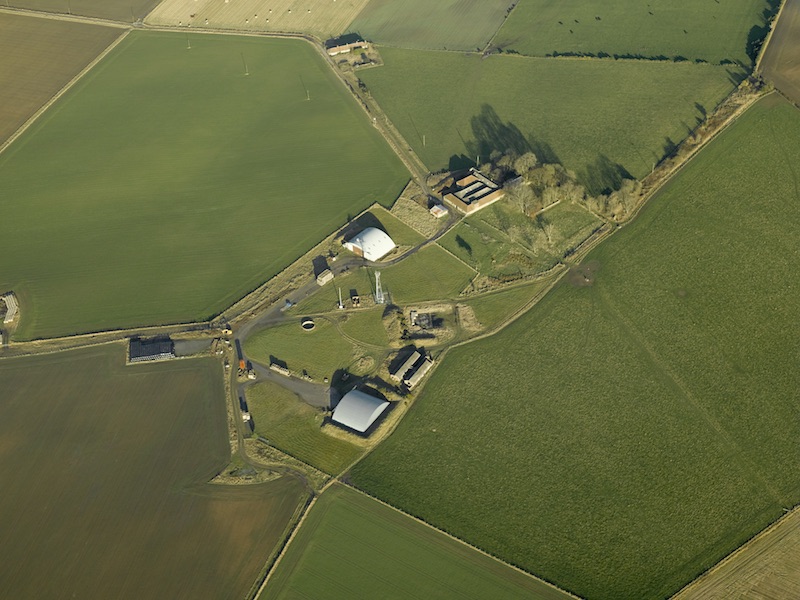
Aerial view centred on the north-east dispersal area with the farmstead adjacent, taken from the south, 23 November 2007. © Crown Copyright: HES. Licensor canmore.org.uk
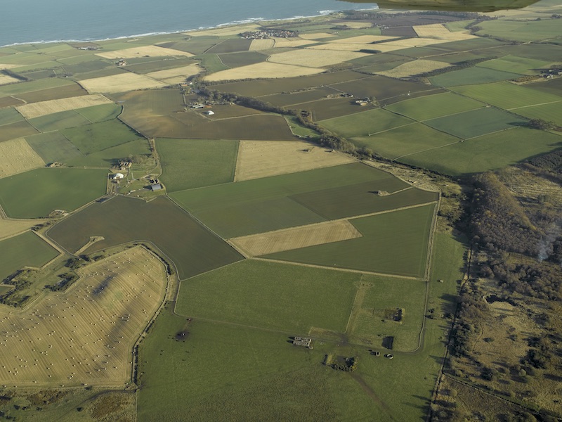
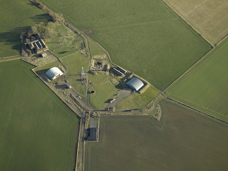
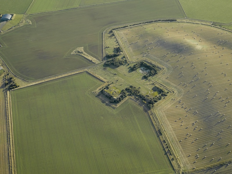
Aerial view centred on the airfield, taken from the south-south-west, 23 November 2007. © Crown Copyright: HES. Licensor canmore.org.uk
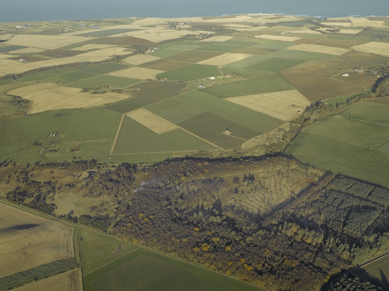
Aerial view centred on the airfield, taken from the south-west, 23 November 2007. © Crown Copyright: HES. Licensor canmore.org.uk
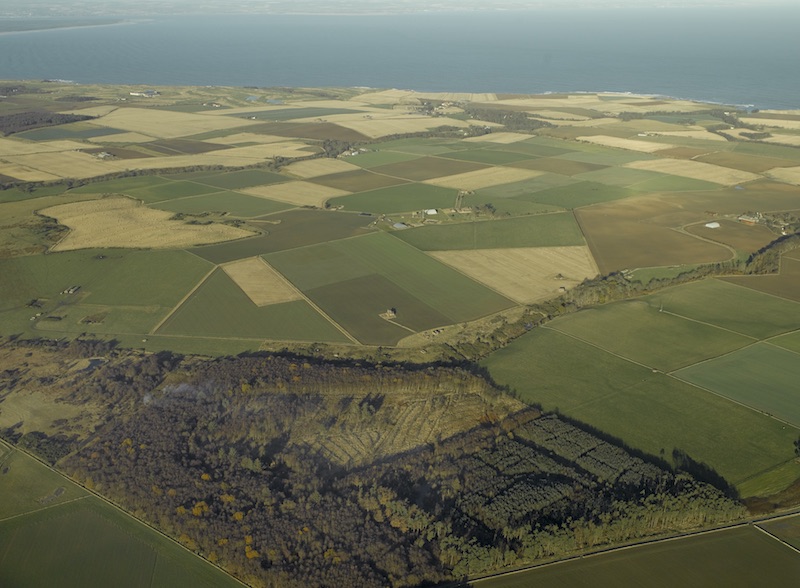
Aerial view centred on the airfield, taken from the west, 23 November 2007. © Crown Copyright: HES. Licensor canmore.org.uk
Aerial view centred on the domestic site, taken from the north-north-west, 23 November 2007. © Crown Copyright: HES. Licensor canmore.org.uk
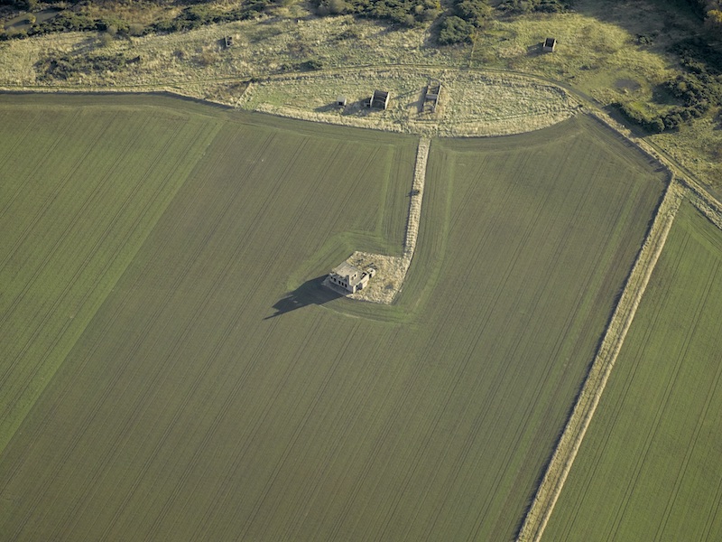
Aerial view centred on the control tower, taken from the north-west, 23 November 2007. © Crown Copyright: HES. Licensor canmore.org.uk
Aerial view centred on the control tower, taken from the south-west, 23 November 2007. © Crown Copyright: HES. Licensor canmore.org.uk
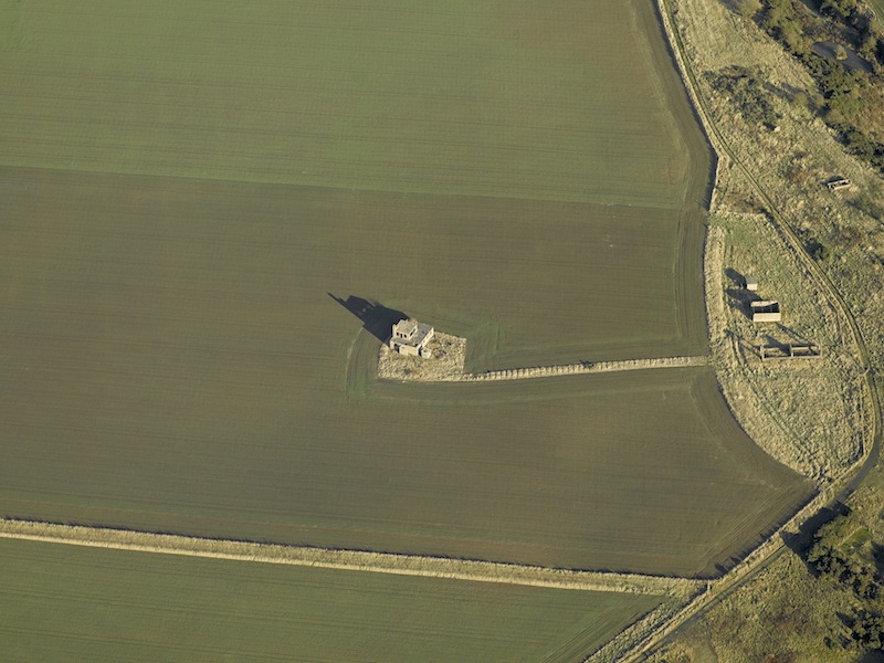
Aerial view centred on the remains of the aircraft hangar dispersal area, taken from the north-west, 23 November 2007. © Crown Copyright: HES. Licensor canmore.org.uk
Aerial view centred on the remains of the aircraft hangar dispersal area, taken from the west-north-west, 23 November 2007. © Crown Copyright: HES. Licensor canmore.org.uk
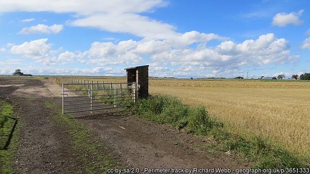
The perimeter track at Dunino, 8 September 2013.
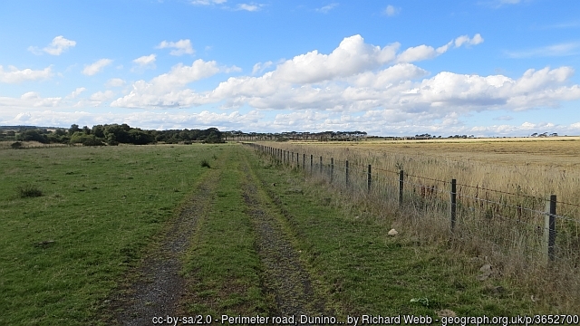
The perimeter track at Dunino, 8 September 2013.
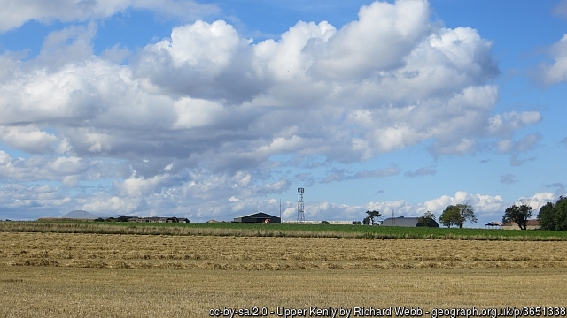
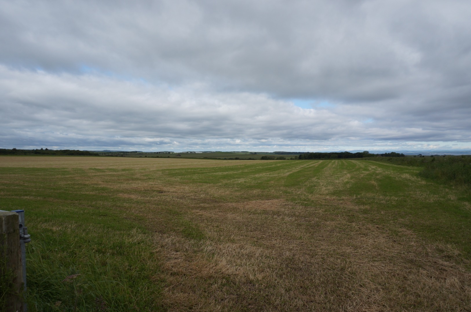
View across Dunino airfield, 8 September 2013.
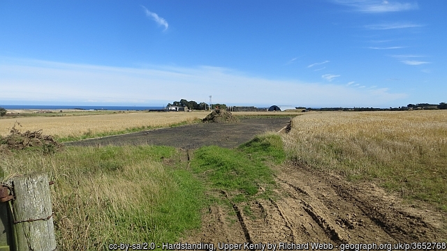
Hardstanding at a dispersal site at Dunino, 8 September 2013.
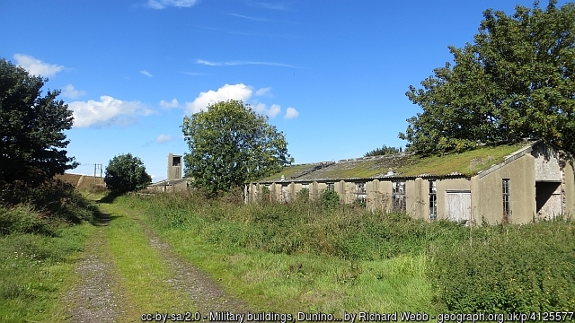
Second World War buildings at Dunino, 8 September 2013.
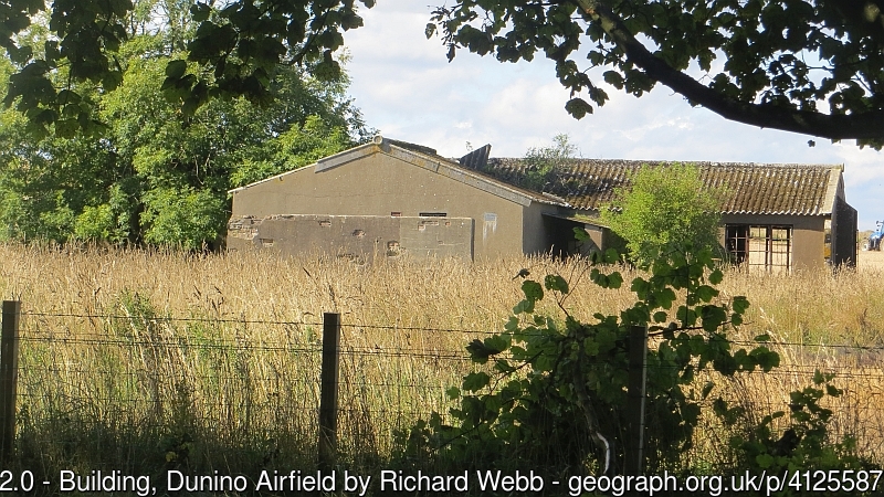
A Second World War building at Dunino, 8 September 2013.
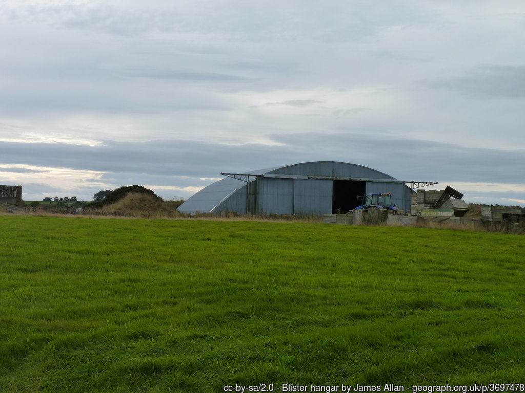
A blister hangar at Dunino, 7 October 2013.
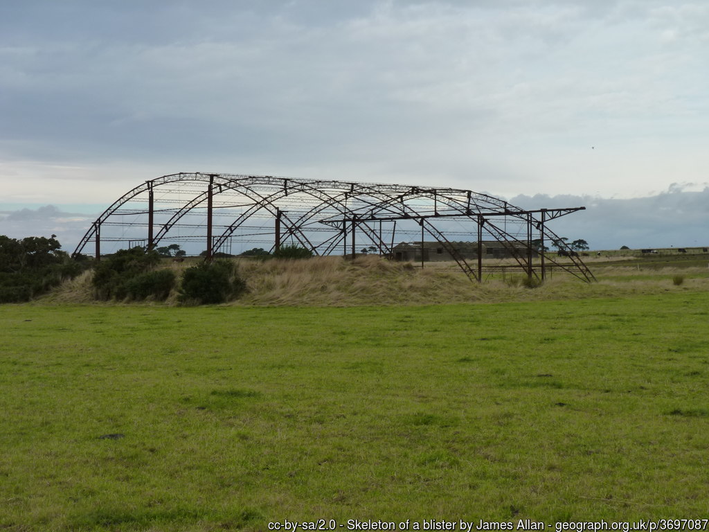
The remains of a blister hangar at Dunino, 7 October 2013.
Long distance view of Dunino, as seen from the south, 25 June 2019.
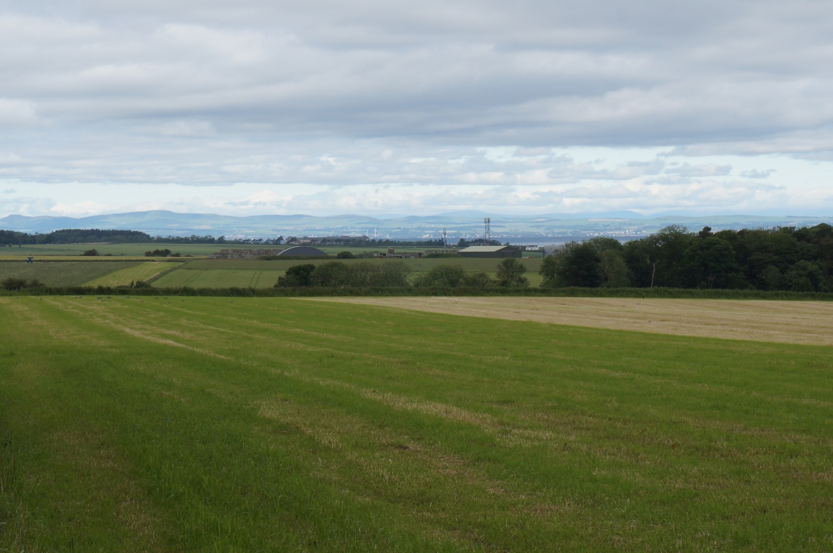
Long distance view of Dunino with a Blister notably evident, as seen from the south, 25 June 2019.
Footage of Dunino, c. 2015. Courtesy of Jag Betty
Footage of Dunino, c. 2015. Courtesy of Jag Betty
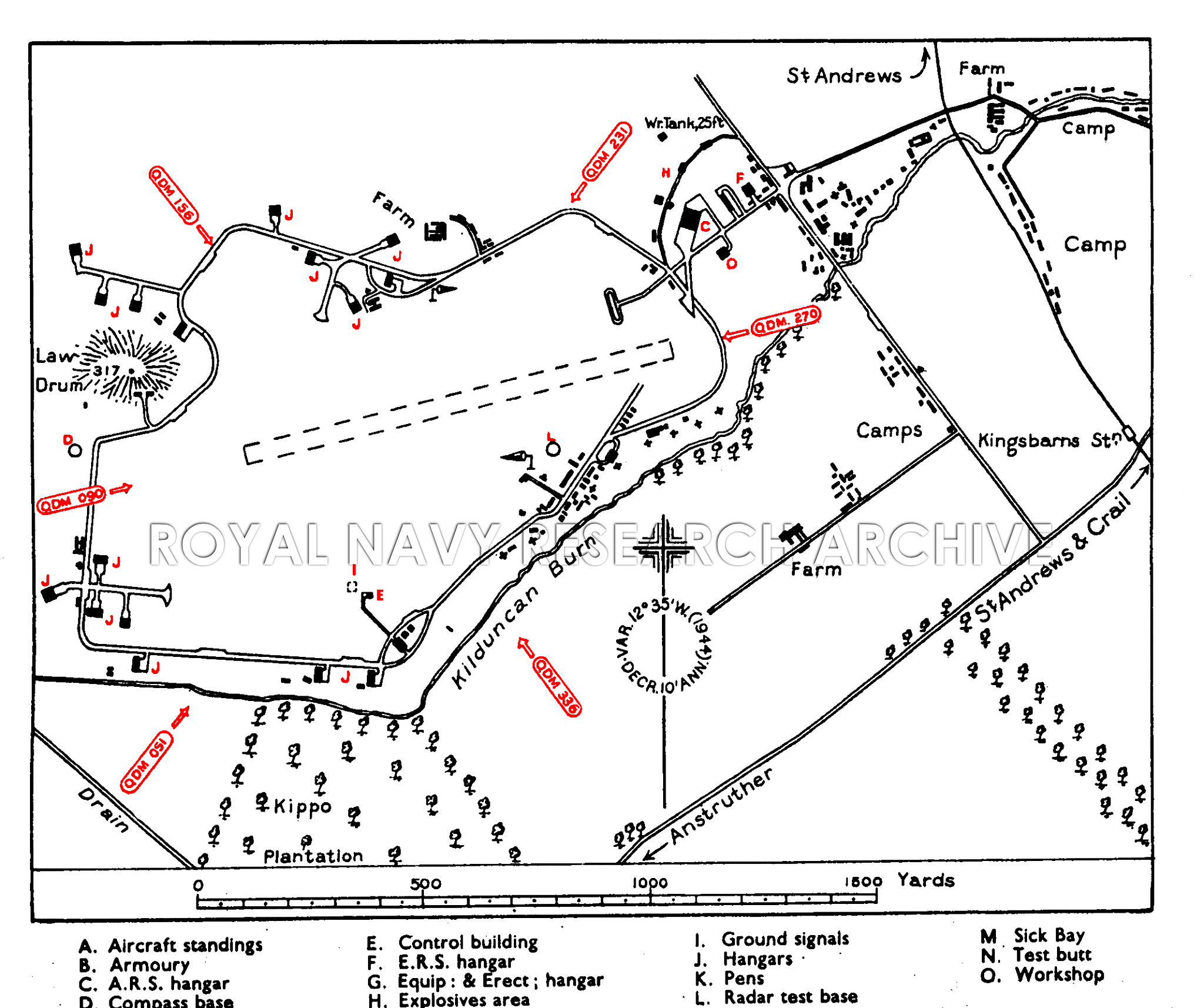
Plan of Dunino, c. 1940s. © Royal Navy Research Archive. Click here for more information.
| Parent(s)/HQ Airfield(s): |