Dale
| Also known as: | Dale Aerodrome / HMS Goldcrest / RAF Dale / RAF Station, Dale / RN Air Station, Dale / RNAS Dale |
| County: | Pembrokeshire |
| Current Status: | Farmland |
| Date: | 1 June 1942 - 31 January 1948 |
| Current Use: | Disused |
| Used By: | RAF / RAF (Polish) / FAA |
| Landing Surface Types: | Paved |
| Aircraft Roles: | Maritime patrol (main role) / Military development/support / Naval aviation |
Built on a peninsula and with several of the runway approaches over cliffs, Dale opened in June 1942 as a satellite for the nearby RAF Talbenny. The frontline No 304 (Polish) Squadron immediately moved in and the squadron's Vickers Wellington aircraft carried out missions including convoy protection, anti-submarine patrols and bombing raids in Occupied France.
In April 1943 the Coastal Command Development Unit (CCDU) took control of the airfield. This unit carried out important work evaluating new equipment as well as teaching and developing new tactics. The unit therefore operated a very diverse range of aircraft types.
September 1943 saw the airfield transfer from the RAF to the Royal Navy and Dale was used by various Royal Navy training units until its closure to flying in 1948. The Admiralty made several improvements to Dale such as a new concrete apron, the building of a new control tower, concrete huts and at least two naval Mainhill hangars to supplement the existing T2 and Blister hangars. Under Navy control, the airfield was known as HMS Goldcrest and a number of different units operated from the airfield. These included No 794 Squadron (also referred to as the Naval Air Firing Unit), carrying out target-towing duties, and a twin-engine conversion unit providing training for larger aircraft in the Fleet Air Arm such as Bristol Beaufighters. A Fighter Direction School and a Night Fighter School were also established at Dale and operated briefly in the last few years of the airfield’s active life. Also heavily associated with Dale was the ground station of Kete to the south. This was an Aircraft Direction Centre, carrying out radar training, which opened late in World War Two and co-operated with Dale, using it as its flying base. After World War Two there was naval equipment storage here under the control of a major depot at Milford Haven until the early 1960s.
The dispersal points, hangars, workshops and accommodation blocks were to the northeast of the runways. The airfield is now primarily farmland, although the runways and hardstandings are still visible. A number of the buildings still stand and a hut group is now listed. The Pembrokeshire Coast Path uses the southern and western sections of the perimeter track.
The following organisations are either based at, use and/or have at least potentially significant connections with the airfield (as at 01/07/2013):
- Coastlands Local History Group
- Dale Community Council
- Marloes & St Brides Community Council
- Pembrokeshire Model Club
-
St Peter's Church, Marloes
-
Teifi Valley Motor Club
ABCT would like to thank the Royal Commission on the Ancient and Historical Monuments of Wales for the use of their images. Find out more here: www.rcahmw.gov.uk and search their database here: www.coflein.gov.uk.
Main unit(s) present:
- No 304 Sqn
- No 748 Sqn
- No 762 Sqn
- No 784 Sqn
- No 790 Sqn
- No 794 Sqn
- No 809 Sqn
- No 861 Sqn
- No 897 Sqn
- No 1770 Sqn
- Coastal Command Development Unit
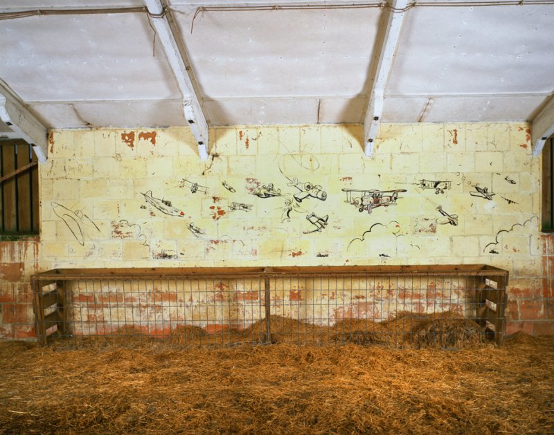
View of wallpainting on the west wall of the accommodation block at Dale Airfield, 15 November 2005. © Crown copyright: Royal Commission on the Ancient and Historical Monuments of Wales.
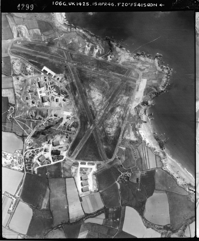
Aerial view of Dale Airfield, 1946. From the collections of the National Monuments Record of Wales: © Crown copyright: MoD.
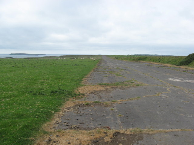
Looking north-west along the perimeter track at Dale, 28 September, 2009. © Dr Duncan Pepper and licensed for reuse under this Creative Commons Licence
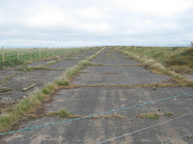
Looking south-east along the perimeter track at Dale, 28 September 2009. © Dr Duncan Pepper and licensed for reuse under this Creative Commons Licence
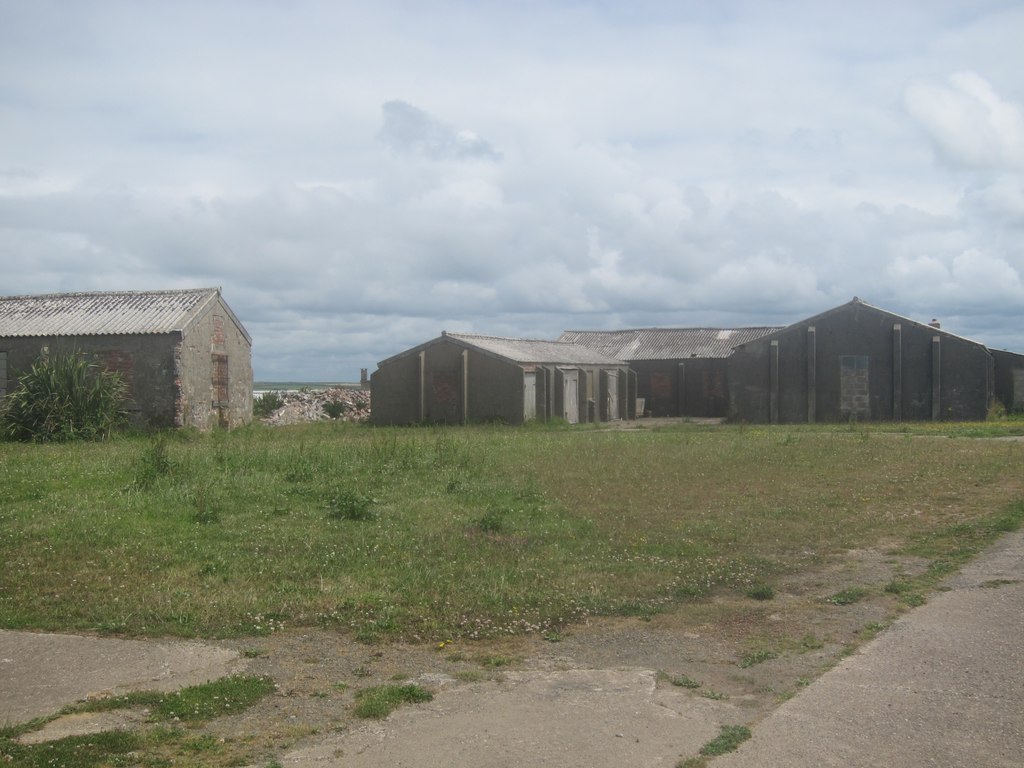
Domestic quarters at the north-east corner of the airfield, 13 July 2014. © Dr Duncan Pepper and licensed for reuse under this Creative Commons Licence
Domestic quarters at the north-west corner of the airfield, 13 July 2014. © Dr Duncan Pepper and licensed for reuse under this Creative Commons Licence
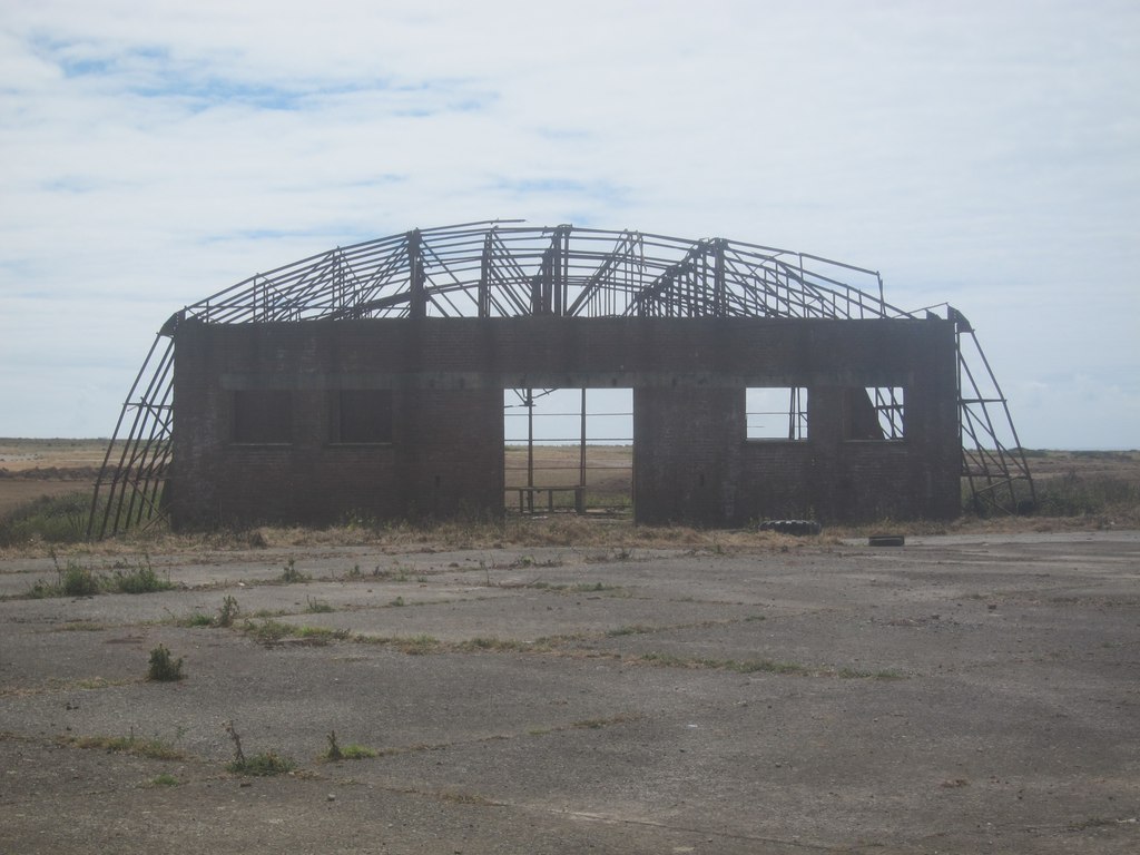
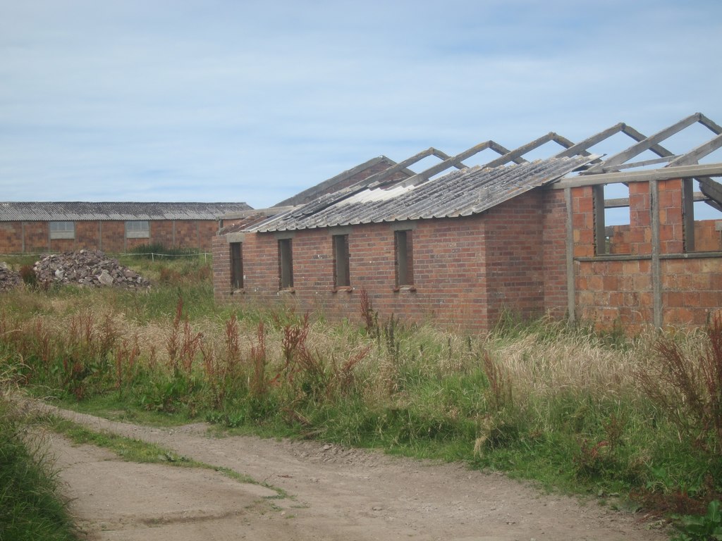
Remains of a hangar at Dale, 13 July 2014. © Dr Duncan Pepper and licensed for reuse under this Creative Commons Licence
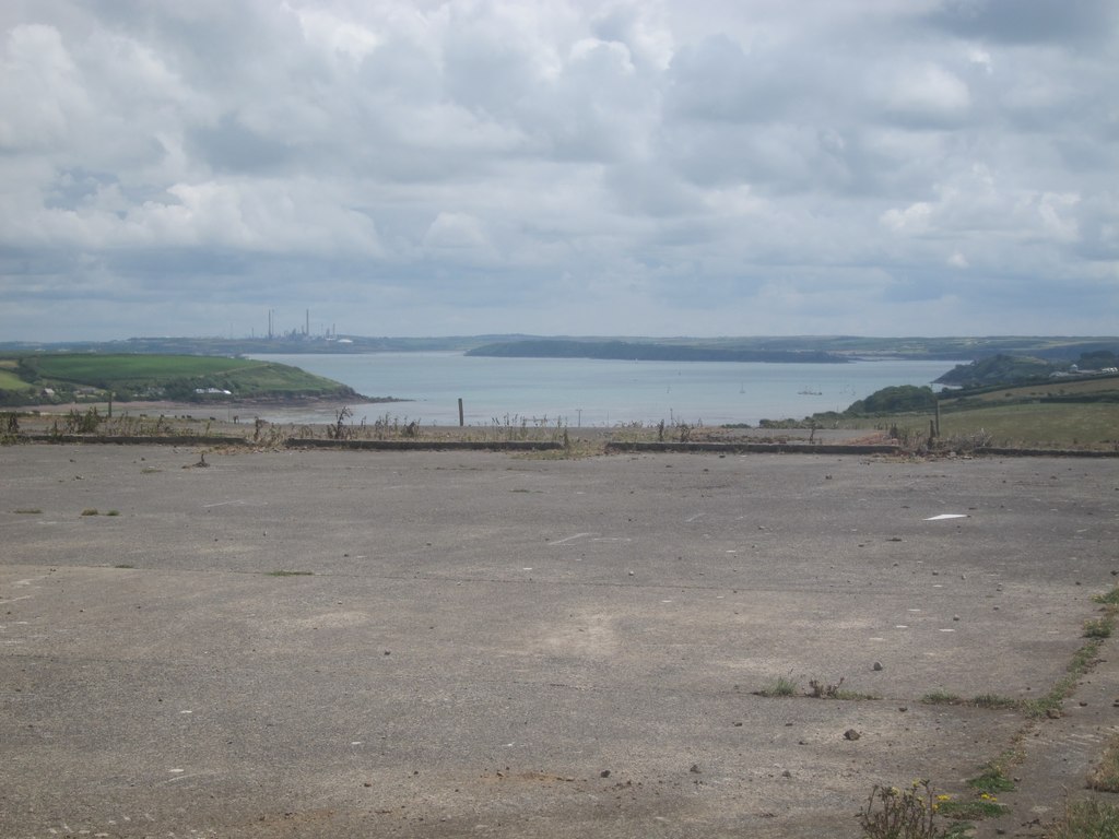
A dispersal area at the edge of Dale airfield, 13 July 2014. © Dr Duncan Pepper and licensed for reuse under this Creative Commons Licence
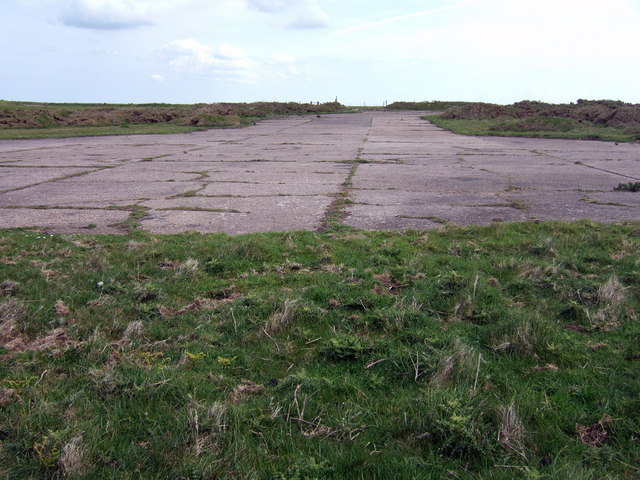
Looking down one of the runways at Dale, 21 May 2007. © ceridwen and licensed for reuse under this Creative Commons Licence
Aerial footage of Dale. Courtesy of Lyndon Hooper
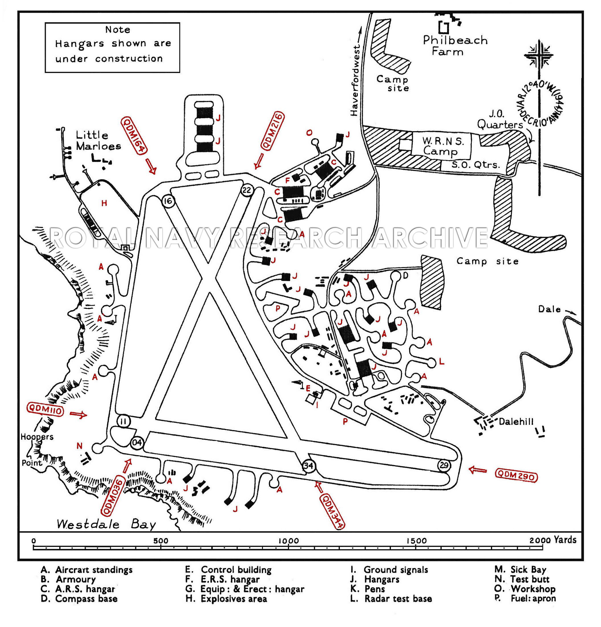
Plan of Dale, c. 1940s. © Royal Navy Research Archive. Click here for more information.